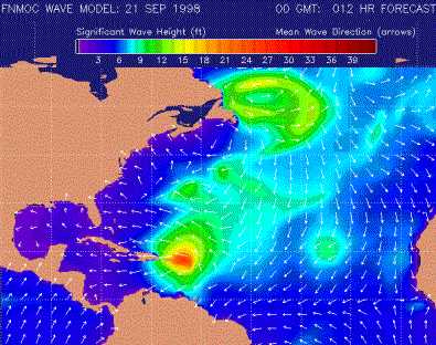
 Hurricane
Georges in the Caribbean, was rated a Category 4 hurricane on the Saffir-Simpson
scale, and has grown strong and dangerous on Saturday (19 Sep 98).
It reached a maximum sustained winds of 150 mph (up to 248 kph) at its
peak intensity on Sunday Morning the 20 Sep 98. However, by 11 pm Sunday
evening, the sustained wind speed has decreased down to 70 mph on the island
of Desirade.
Hurricane
Georges in the Caribbean, was rated a Category 4 hurricane on the Saffir-Simpson
scale, and has grown strong and dangerous on Saturday (19 Sep 98).
It reached a maximum sustained winds of 150 mph (up to 248 kph) at its
peak intensity on Sunday Morning the 20 Sep 98. However, by 11 pm Sunday
evening, the sustained wind speed has decreased down to 70 mph on the island
of Desirade.
Rainfall near the path of Georges is expected to reach 5 to 10 inches
and that a storm is expected to surge up 4 to 7 feet above normal tide
levels near and to the north of where the hurricane interacts with the
islands.
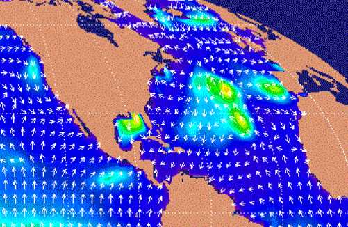
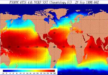 http://www.marineweather.com/SSTMGLB.html
![]() Hurricane
is the name for a tropical cyclone with sustained winds of 74 miles per
hour (65 knots) or greater in the North Atlantic Ocean, Caribbean Sea,
Gulf of Mexico, and in the eastern North Pacific Ocean. This same tropical
cyclone is known as a typhoon in the western Pacific and a cyclone in the
Indian Ocean.
Hurricane
is the name for a tropical cyclone with sustained winds of 74 miles per
hour (65 knots) or greater in the North Atlantic Ocean, Caribbean Sea,
Gulf of Mexico, and in the eastern North Pacific Ocean. This same tropical
cyclone is known as a typhoon in the western Pacific and a cyclone in the
Indian Ocean.
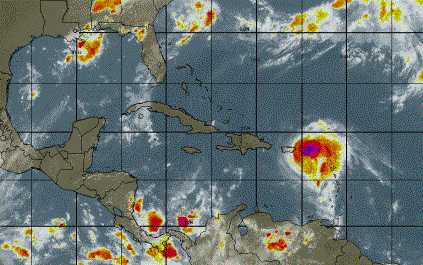
![]() http://www.intellicast.com/weather/intl/hicbsat/
http://www.intellicast.com/weather/intl/hicbsat/
![]()
These images were taken on the 21st September where the wind has
gone down to 77 mph.
After hitting all those islands in the Caribeans, Georges was barely a hurricane with sustained winds of 75 mph on Wednesday afternoon (23 Sep 98). The pressure was then all the way up to 29.44 in. Certain time however, the pressure of Georges was down to 27.67 in. and this is way off the scale on a home barometer.
By Thursday morning (24 Sep 98), after going through the mountainous islands of the northern Caribbean, i.e. northern Lesser Antilles, Puerto Rico, the Dominican Republic, and Haiti, Georges had sustained winds of 75 mph. The storm has been kept as a category 1 on the Saffir-Simpson scale. However, there is a possibility that Georges might strengthen into category 2 over the warm waters north of Cuba. Although the winds are currently diminished, torrential, flooding rains remain a devastating threat. It is estimated that any landfall or close call in Florida will occur Friday and Friday night. Thereafter, Hurricane Georges may move towards Southeast, and along the northeast Gulf Coast.
 http://www.intellicast.com/weather/intl/hicbsat/
![]() On
Sun 27 Sep 98, at a sustained winds of 110 mph, Hurricane Georges continues
slowly towards Mississippi coast. Tides near and to the east
of the eye of Georges is expected to run as much as 10 to 17 feet above
normal, while rainfall amounts could be measured in feet. Serious flooding
is expected in parts of Alabama and Mississippi, eastern Louisiana and
the Florida Panhandle over the next 2 to 3 days.
On
Sun 27 Sep 98, at a sustained winds of 110 mph, Hurricane Georges continues
slowly towards Mississippi coast. Tides near and to the east
of the eye of Georges is expected to run as much as 10 to 17 feet above
normal, while rainfall amounts could be measured in feet. Serious flooding
is expected in parts of Alabama and Mississippi, eastern Louisiana and
the Florida Panhandle over the next 2 to 3 days.
 http://www.marineweather.com/waveglobal.html
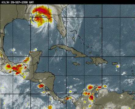
By Mon 28 Sep 98, Hurricane Georges sustained winds is reported to
be 105 mph and it has been reported in Escambia County, Florida, that more
than 15 inches of rain has fallen since midnight Sunday.
|
And to wrap it all up, you can read the summary on Hurricane Georges by the US National Hurricane Center at: http://www.hurricanehunters.com/georges.htm You can also view photos taken during the storm itself. Other
Sites to view:-
|
|
|
|
|
|