 Typhoon
Zeb hits the Philippines and Taiwan on Wednesday 14 Oct 98 at a packed
winds of nearly 300 Km/h (190 miles/h), ripping down bridges and homes
in its path. In fact, it is the biggest typhoon to hit the Philippines
in 3 years, i.e. since Angela in Nov 95 which killed about 700 people.
Typhoon
Zeb hits the Philippines and Taiwan on Wednesday 14 Oct 98 at a packed
winds of nearly 300 Km/h (190 miles/h), ripping down bridges and homes
in its path. In fact, it is the biggest typhoon to hit the Philippines
in 3 years, i.e. since Angela in Nov 95 which killed about 700 people.
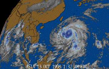 The
typhoon reached its peak winds of 240 Km/h (149 miles/h) and gusts of 295
Km/h (183 miles/h) at the town of Palanan in the morning. There were
reports of flooding, landslides and several bridges destroyed by the typhoon.
Typhoon Zeb was forecasted to move nortwest at 20 Km/h (12 miles/h) and
out in the China Sea by Thursday morning.
The
typhoon reached its peak winds of 240 Km/h (149 miles/h) and gusts of 295
Km/h (183 miles/h) at the town of Palanan in the morning. There were
reports of flooding, landslides and several bridges destroyed by the typhoon.
Typhoon Zeb was forecasted to move nortwest at 20 Km/h (12 miles/h) and
out in the China Sea by Thursday morning.
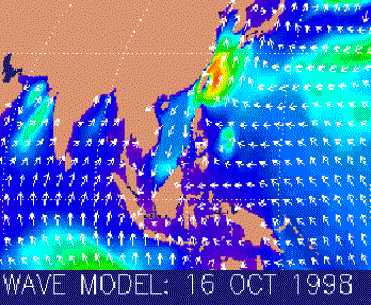 Over
in Sabah, we only experienced strong sea winds of up to 30 mph, with waves
height of up to 1.5 meter on Tuesday (13 Sep 98). By 14 Sep
98, the sea winds has strengthened to 50 mph, but thr sea waves maintined
at a height of 1.5 - 2.0 metres.
Over
in Sabah, we only experienced strong sea winds of up to 30 mph, with waves
height of up to 1.5 meter on Tuesday (13 Sep 98). By 14 Sep
98, the sea winds has strengthened to 50 mph, but thr sea waves maintined
at a height of 1.5 - 2.0 metres.
![]()
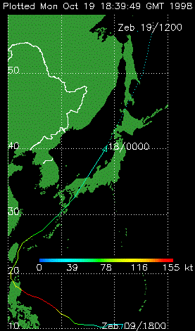
 By
16 Oct 98, Typhoon Zeb is moving North-Northeasward at 15 knots.
Maximum sustained winds were 80 knots gusting to 100 knows.
Weather forecast by The Malaysian Meteorological Services on same day that
the sea winds at 20 - 40 mph SW and that waves height around Sabah will
be 1.5 - 2.0 m.
By
16 Oct 98, Typhoon Zeb is moving North-Northeasward at 15 knots.
Maximum sustained winds were 80 knots gusting to 100 knows.
Weather forecast by The Malaysian Meteorological Services on same day that
the sea winds at 20 - 40 mph SW and that waves height around Sabah will
be 1.5 - 2.0 m.
Hurricane is the
name for a tropical cyclone with sustained winds of 74 miles per hour (65
knots) or greater in the North Atlantic Ocean, Caribbean Sea, Gulf of Mexico,
and in the eastern North Pacific Ocean. This same tropical cyclone is known
as a typhoon in the western Pacific and a cyclone in the Indian Ocean.
![]()
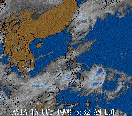
View latest satelite pictures on cloud spread in the Philippines
and Taiwan at:
http://www.weather.com/images/sat/asiasat_756x484.gif
View latest waves height and wind directions at: http://www.marineweather.com/waveglobal.html
View sea surface temperature at: http://www.marineweather.com/SSTMGLB.html
![]()
|
|
|